Log in
All resources
Create a design
2,977 Free Artworks of City Map
john rocque
john rocque 1746 crops from library of congress
bibliothèque nationale de france
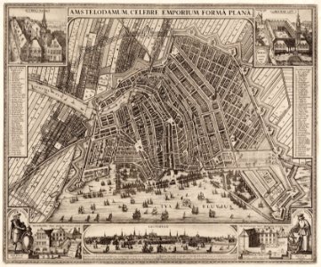
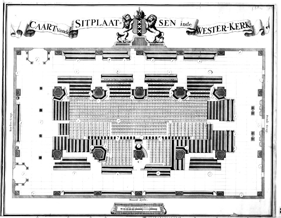
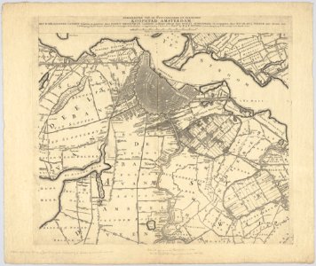
maps in the stadsarchief amsterdam
hendrik de leth
remigius parr
john rocque's 1748 map of london and adjacent country
historical sketch book and guide to new orleans and environs (1885)
koizumi yakumo
maps in the rijksmuseum amsterdam
bibliothèque nationale de france
dheulland map of paris
maps of venlo by willem and johannes blaeu
fortifications of venlo
maps of windsor by braun & hogenberg
maps of oxford by braun & hogenberg
maps of cambridge by braun & hogenberg
bibliothèque nationale de france
maps in the stadsarchief amsterdam
hendrik de leth
civitates orbis terrarum. de praecipuis totius universi urbibus. liber secundus
maps of emmerich by braun & hogenberg
civitates orbis terrarum. de praecipuis totius universi urbibus. liber secundus
maps of kleve by braun & hogenberg
civitates orbis terrarum. de praecipuis totius universi urbibus. liber secundus
maps of pozzuoli by braun & hogenberg
1100 block of royal street, french quarter
1885 in new orleans
asia noviter delineata
john rocque 1746 crops from library of congress
john rocque
john rocque 1746 crops from library of congress
john rocque
john rocque 1746 crops from library of congress
john rocque
john rocque 1746 crops from library of congress
john rocque
john rocque 1746 crops from library of congress
john rocque
john rocque 1746 crops from library of congress
john rocque
john rocque 1746 crops from library of congress
john rocque
john rocque 1746 crops from library of congress
john rocque
john rocque 1746 crops from library of congress
john rocque
john rocque 1746 crops from library of congress
john rocque
john rocque 1746 crops from library of congress
john rocque
maps of goa by braun & hogenberg
john rocque 1746 crops from library of congress
john rocque
john rocque 1746 crops from library of congress
john rocque
john rocque 1746 crops from library of congress
john rocque
john rocque 1746 crops from library of congress
john rocque
john rocque 1746 crops from library of congress
john rocque
john rocque 1746 crops from library of congress
john rocque
john rocque 1746 crops from library of congress
john rocque
atlas schoemaker-friesland
maps of smallingerland
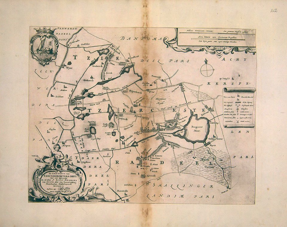
atlas schoemaker-friesland
maps of dantumadiel
drawings by niels larsen stevns in the statens museum for kunst
print
maps in the stadsarchief amsterdam
hendrik de leth
maps of country estates in the netherlands
het zegepralent kennemerlant
joost van geel
de lier
map of amsterdam by gerrit de broen (ii)
maps in the rijksmuseum amsterdam
portrait of george washington by giuseppe perovani
giuseppe perovani
maps in the rijksmuseum amsterdam
nieuwe cronyk van zeeland
birds-eye view of seattle, 1884
ships in puget sound
maps of budapest by braun & hogenberg
1572 in buda
maps of agnano and grotta del cane by braun & hogenberg
context files from gallica
maps in the stadsarchief amsterdam
hendrik de leth
maps in the stadsarchief amsterdam
hendrik de leth
maps in the stadsarchief amsterdam
hendrik de leth
maps in the stadsarchief amsterdam
hendrik de leth
maps of galicia by mercator-hondius
salomon rogiers
dutch 18th-century prints in the rijksmuseum amsterdam
old maps of roermond
18th-century double hemisphere world maps
1760s maps of the world
atlas schoemaker-overijssel
history of deventer
sconces in north rhine-westphalia
rheinberg in the 1650s
maps in the stadsarchief amsterdam
claes jansz. visscher (ii)
maps in the stadsarchief amsterdam
hendrik de leth
maps in the stadsarchief amsterdam
hendrik de leth
maps in the stadsarchief amsterdam
hendrik de leth
atlas schoemaker-friesland
maps of achtkarspelen
atlas schoemaker-friesland
maps of tytsjerksteradiel
korte beschryvinghe (1686)-hungary
székesfehérvár in the 17th century
hospital de la resurrección, valladolid
alfred guesdon
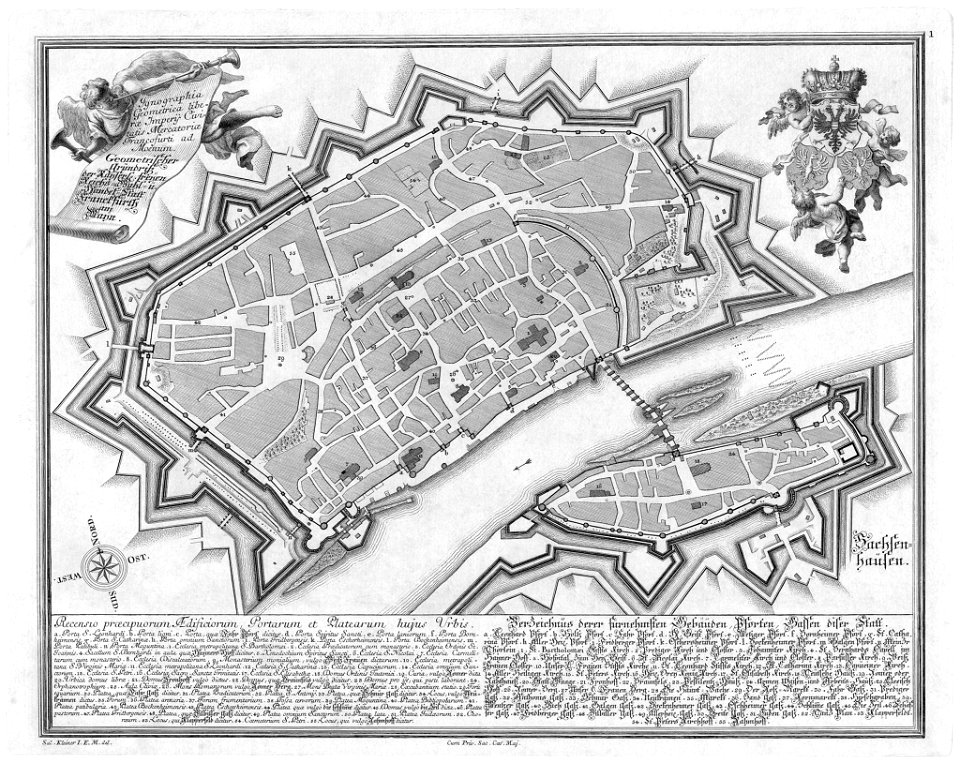
18th-century maps of frankfurt am main
das florirende franckfurth am mayn
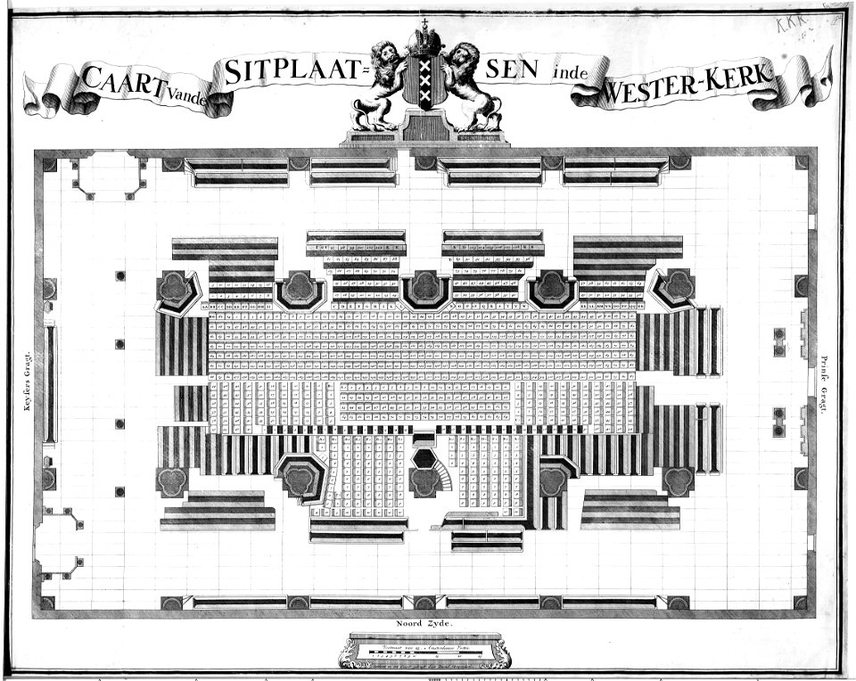
construction drawings in the stadsarchief amsterdam
daniel stoopendaal
construction drawings in the stadsarchief amsterdam
daniel stoopendaal
1747 in berlin-friedrichshain
1747 in berlin-mitte
high renaissance
pirro ligorio
atlas schoemaker-overijssel-deel1 en 2
atlas schoemaker-overijssel
collection cartographic documents from het utrechts archief
prints by jan van vianen
maps in the rijksmuseum amsterdam
maps by gerard valck
maps of the iberian peninsula by mercator-hondius
maps by pieter van der keere
atlas des anciens plans de paris by imprimerie nationale, 1880 from bhvp
proletarian literature
17th-century maps of vienna
bartholomeo camuccio
17th-century maps of vienna
bartholomeo camuccio
civitates orbis terrarum. de praecipuis totius universi urbibus. liber secundus
maps of brielle by braun & hogenberg
bremen in topographia saxoniae inferioris (merian)
baroque
japanese paintings in the rijksmuseum amsterdam
kawahara keiga
lawrence h. slaughter collection of english maps, charts, globes, books and atlases
nypl lionel pincus and princess firyal map division
atlas des anciens plans de paris by imprimerie nationale, 1880 from bhvp
dheulland map of paris
atlas des anciens plans de paris by imprimerie nationale, 1880 from bhvp
dheulland map of paris
etchings in the rijksmuseum amsterdam
maps in the rijksmuseum amsterdam
maps of paris from the david rumsey historical map collection
maps of paris by braun & hogenberg
maps in the stadsarchief amsterdam
daniel stoopendaal
maps in the stadsarchief amsterdam
daniël veelwaard (i)
1779 maps of the united states
1770s maps of the caribbean
old maps of brooklyn, new york city
john douglas woodward
swamps in louisiana
1885 in louisiana
fortifications of hamburg
gates in hamburg
steinfels collection
engravings of bern
maps in the rijksmuseum amsterdam
hendrik de leth
royal street, french quarter
cafés in new orleans
historical sketch book and guide to new orleans and environs (1885)
madame john's legacy
orleans street, french quarter
arecaceae in new orleans
maps of paris from the barry lawrence ruderman antique maps inc.
maps of paris by braun & hogenberg
peter schmidtmeyer
agostino aglio
spanish–algerian war (1775–1785)
maps by tomas lopez
john rocque's 1748 map of london and adjacent country
remigius parr
john rocque's 1748 map of london and adjacent country
remigius parr
john rocque's 1748 map of london and adjacent country
remigius parr
john rocque's 1748 map of london and adjacent country
remigius parr
john rocque's 1748 map of london and adjacent country
remigius parr
john rocque's 1748 map of london and adjacent country
remigius parr
john rocque's 1748 map of london and adjacent country
remigius parr
john rocque's 1746 map of london
remigius parr
1801 - 1900 of 2,977
Next page
/ 30